Localization

Highly accurate localization – precise, reliable and secure!

Your solution partner for the autonomous mobility of the future

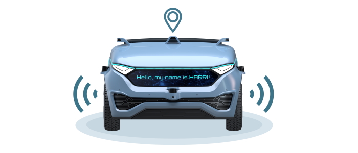
Always knowing where a movable object is located at any one time is an essential basic prerequisite for the functionality of autonomous systems and their reliable operation, both on the road and in the third dimension. In recent years, the highly precise determination of the position of persons, vehicles, operating and production equipment or other moving objects with an accuracy of a just few centimeters has become a vitally important key component. Whether it is at autonomous vehicle depots, in fully automated warehouses or during autonomous driving, highly accurate localization must function reliably independent of the surroundings and environmental influences.

How localization works.

On an open road, localization is very reliable in most situations due to the use of satellite-based systems (GNSS) and especially due to the provision of correction data. These corrections compensate for dynamic influences caused by interference in the atmosphere or the satellite’s orbit. In order to avoid possible falsifications, we rely on redundant data sources and the following technologies to ensure precise, secure and above all continuous localization:


Satellite navigation

Icon eines Satelliten

Environment sensors

Icon eines Fahrzeugs mit Umweltsensorik.

Inertial sensors

Icon aus Pfeilen die in drei Richtungen zeigen.

However, there is no universal recipe for localization solutions. Automatic positioning can be achieved by using a wide range of different technologies, from satellite navigation to inertial sensors and various other types of sensors for the perception of the surroundings. Which type or which combination of sensors is the most suitable will depend on the required location accuracy, the required update rate and the environment.

A particular challenge is posed by situations in which the reception of satellite signals is disrupted in densely built-up areas or in tunnels. In such cases, the loss of the signal means that autonomous systems increasingly lose their orientation and can no longer estimate their own continued movement. For outdoor localization, GNSS can provide a highly accurate and continuously stable position. For indoor localization on the other hand, wireless technologies such as IEEE 802.11 (wi-fi), Bluetooth, ZigBee, RFID and ultra-wideband (UWB) are used to provide a stable position, while radar, ultrasound or visual technologies such as lidar and cameras are employed to ensure greater accuracy.

Icon von HARRI

Bertrandt as a solution provider for your localization requirements

Continuous positioning not only indoors and outdoors, but also in transition situations – our experts can offer you a wide variety of individual solutions. . By sensor fusion based raw data from various sensors as well as a continuous comparison with high-resolution maps, we can achieve accurate positioning with a delay of just a few milliseconds.

Overview of our solutions for you:

As a global, satellite-based positioning system, GNSS provides stable localization of the target system outdoors, both on the ground and in the air. If a supply of correction data is also ensured, GNSS can already deliver a highly accurate and continuously stable position in many everyday situations. Tailored to your specific needs, our experts will define whether base systems (GPS, GLONASS, Galileo or BeiDou) should be excluded in your application case. The provision and operation of one’s own base stations is also a possibility for ensuring additional accuracy and greater robustness of the system. Positioning errors of significantly less than 50 cm can be achieved in this way. For even better results, our experts are also able to fuse the output of this system with other localization systems.   

Your benefits at a glance:

  • Different GNSS receivers for different use cases – from a low-cost entry-level system to a robust dual-frequency receiver with an antenna for the suppression of multipath propagation
  • Centimeter-accurate positioning outdoors by means of correction data from different sources and with adapted transmission channels
  • Development on an automotive scale
  • Expandable with IMU and RTK solutions

Separate solutions currently exist for the localization of vehicles and objects indoors and outdoors. We ensure secure real-time localization of objects, both indoors and outdoors and above all in transition. Bertrandt provides a solution that can be used in both domains in parallel, while also delivering a consistent position in the centimeter range in transition situations. For absolute positioning in situations where there is limited availability of satellite-based systems, ultra-wideband (UWB) radio technology is used, thus replacing a GNSS system. At the same time, an inertial sensor system guarantees a high resolution. According to the modular principle, we select further necessary sensor systems that are individually tailored to your use case.

Your benefit: the infrastructure required for this is particularly small, low-cost and low-maintenance! 

  • Modular sensor fusion for various use cases
  • Centimeter-precise localization outdoors and indoors
  • Continuous localization with no loss of connection
  • Simple system integration
  • Development on an automotive scale

Even without previous information about the position or surroundings, a system using SLAM is able to generate its own map and locate itself in it. Usually, a series of camera or lidar data is used to gradually create the map on the basis of prominent points. This requires a high level of computing power and complex algorithms. When used correctly, SLAM offers a localization accuracy of a few centimeters even in dense, urban areas, but it also brings great challenges in the form of big data and the constantly changing real world.

Our experts will be happy to advise you at any time.

Before a system is able to provide localization, it has to be trained and conditioned. This requires external assistance. If an autonomous system uses SLAM, for example, it requires a map reference that can be compared with itself – a ground truth. However, in order to fulfill the requirements of a reference, the ground truth must be more accurate by several factors. 

If the position of the system is also to be determined on this highly accurate map, this will additionally require a ground truth of the localization that also has a higher accuracy than the test object. For outdoor situations, this can be provided, for example, by INS (Inertial Navigation Systems with GNSS and IMU) and the associated mapping in a suitable format (reference system, origin of coordinates, etc.).

For the generation of a ground truth, the respective referencing task must therefore be carefully considered. Only then is it possible to select the appropriate measuring system, to embed it in the corresponding measuring equipment or evaluation landscape, and to prepare the reference data in a targeted manner in order to generate the ground truth.

Bertrandt can support you by providing expertise in every aspect of a ground truth.

Your benefit: open up many different fields of application with a ground truth.

  • Expert assessment to determine a sensible ground truth
  • Modular hardware solutions for different use cases
  • Implementation of a specific ground truth solution
  • Support in integrating the ground truth into the assessment (metric and KPIs)

For autonomous driving, a high-resolution map is absolutely essential to enable the vehicle to locate its own position and collect information about its surroundings. It serves as a common location reference, also for vehicle and infrastructure sensor data, which, when combined, provide a realistic image of the environment. The Navigation Data Standard (NDS) in particular is the most frequently used database format for vehicle navigation solutions and also provides an excellent map base for autonomous vehicles. 

Our experts not only test map compilations and complete systems, but also secure them at the same time. In addition, they analyze and evaluate map attributes, visualize map data and create maps either with existing raw data or raw data that they have generated themselves. Furthermore, Bertrandt’s own access layer for NDS maps enables us to respond to your personal requirements profile individually and in the shortest possible time.   

By the way: Bertrandt is the first and only development service provider to become a member of the NDS consortium, and due to our close cooperation with the major car makers and the relevant navigation suppliers, we are always at the cutting edge of developments.

Overview of the areas of application.

Die to the technological fusion and evaluation of the data generated, far more areas of application are conceivable in addition to autonomy in the air, on the road, at production plants and on the field. In addition to the pure output of a centimeter-accurate position, our experts can also aggregate and process other recorded data. The evaluation of vehicle data together with its position allows, for example, the creation of route-dependent speed profiles by means of big data analyses, as well as conclusions about the road quality or applications for real-time pattern recognition in traffic jams.


Robotics

Icon eines Roboterarms.

Off-road

Icon eines E-Traktors

Asset tracking

Icon eines LKWs

Drone control

Icon einer Drohne.

Autonomous driving

Icon von einem autonom fahrenden Fahrzeug.

Benefit from our comprehensive localization solutions!


Learn more about our localization solutions!

Data Sheet Localization Fusion

Our experts are happy to help you!

No matter whether it is indoors, outdoors or in transition situations – benefit from our comprehensive knowledge and experience in the fields of hardware integration, software and services for localization, and make use of our far-reaching expertise in functions for autonomous systems.     

Our experts with their many years of experience in the field of localization are available to answer your questions at any time. Please do not hesitate to contact us.   

Your Contact

Jochen Schwenninger

Lead Expert ADAS / AD

Related Topics